1000 Years of History
Eastern European Jewish Communities Project
1,300
Communities
7
Datasets
28
Maps
1000+
Years of History
Data
PolygonsPoints
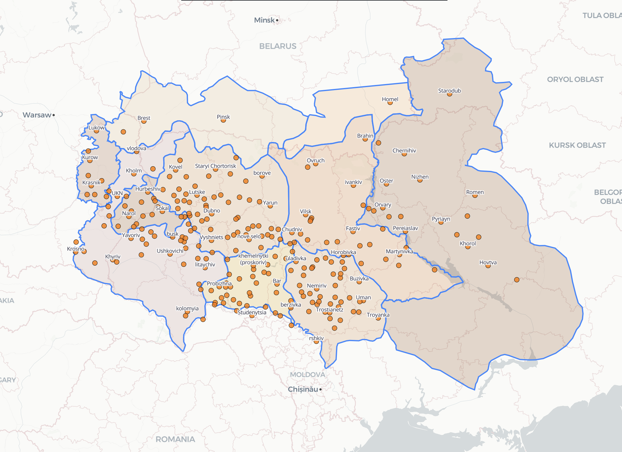
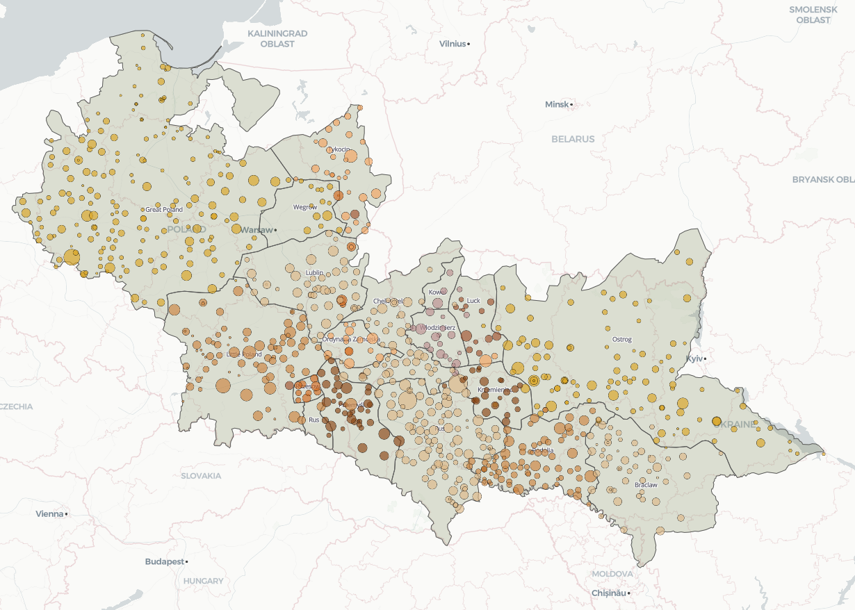
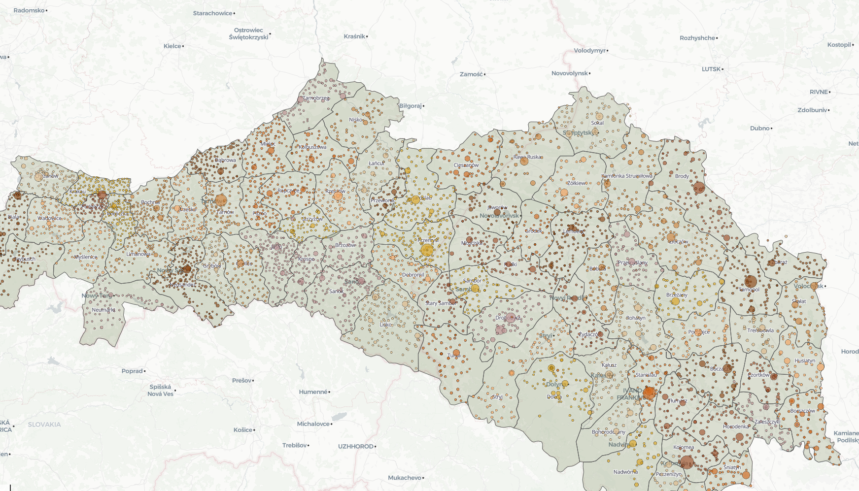
Jewish Communities in Ukraine before the Chmielnicki Uprising (1648)
PolygonsPoints
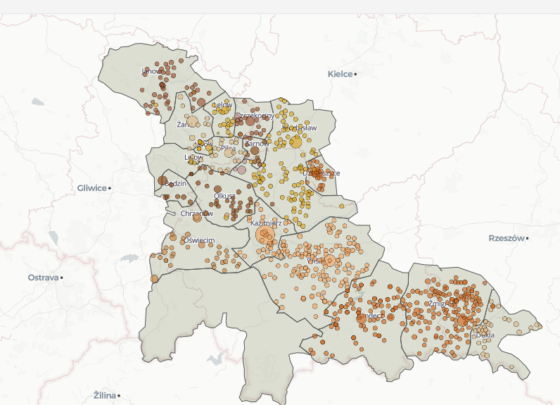
Kahals and Surroundings: Urban and Rural Settlement in Krakow - 1765
PointsCSV
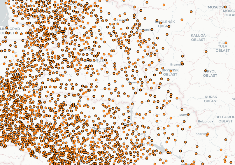
Community Project: Jewish Communities in Eastern Europe and Their Foundation Years
PolygonsPointsCSV
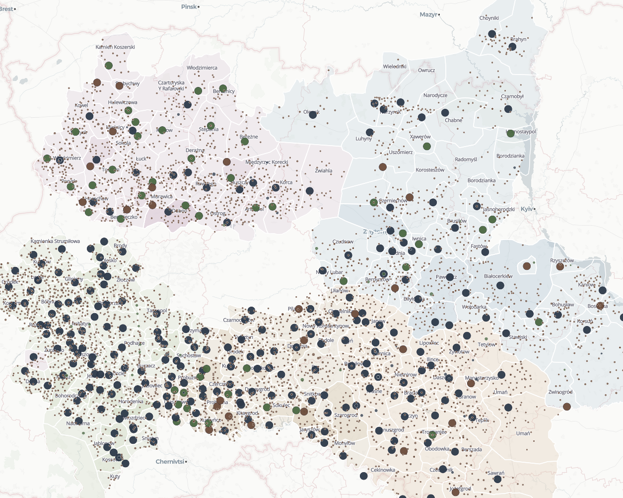
Kahals and Surroundings: Urban and Rural Settlement in Southeastern Poland (Ukraine) - 1765
PolygonsPointsCSV
Kahals and Districts: Kahal Boundaries and Population in the Polish-Lithuanian Commonwealth (1765)
PolygonsPointsCSV
Galicia Census 1890 – Kingdom of Galicia and Lodomeria
All Data
Research Team
Dr. Yannay Spitzer
Principal Investigator · The Hebrew University of Jerusalem
Shneor Shprintsin
Research Assistant · The Hebrew University of Jerusalem
Spitzer, Y., Shprintsin, S. (2024). The Eastern European Jewish Communities Project. The Hebrew University of Jerusalem.